|
|
GPS
& GIS Data
·
Field
CE GIS has all the power of CMT’s proven field software as seen on the
March-II-E and MC-GPS, including RAW data collection and post process
differential. ·
GPS/GIS
data collection with the convenience of a Windows CE environment. ·
With
the ability to load BaseMaps, Field CE GIS provides a complex GIS database on
board. |
|
|
|
|
|
|
|
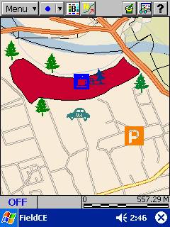
Field
Data Input
·
Field
CE GIS’s enhanced data collection allows on-the-fly HUD
(heads-up-digitizing). ·
With
the click of a button point, line, or area features can be digitized to add
extra data to existing topics. |
|
|
|
|
|
|
|
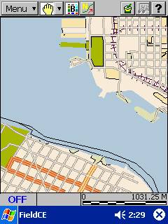
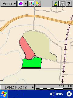
Detailed
BaseMap Data
·
BaseMaps
contain detailed data on Roads, Railroads, Hydrology, City Limits, Key Geographic
Locations, and much more! ·
With
Field CE GIS’s Zoom and Pan functions, BaseMap features can easily accessed
and combined with your lines, points, and areas. |
|
|
|
|
|
|
|
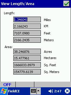
View
Length/Area Function
·
With
the click of a button, length and area of the selected feature can be
displayed. |
|
|
|
|
|
|
|
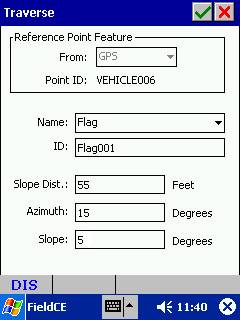
Traverse
Function
·
Field
CE GIS provides an easy to use interface for inputting a series of traverse
data when the GPS signal is not present. ·
All traversed
lines will be calculated and displayed. ·
This
capability will allow mapping in areas such as inside caves or under water. |
|
|
|
|
|
|
|
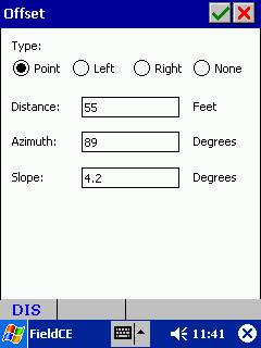
Offset
Feature
·
Storing
an Offset feature when the GPS signal is not present or very weak. |
|
|
|
|
|
|
|
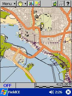
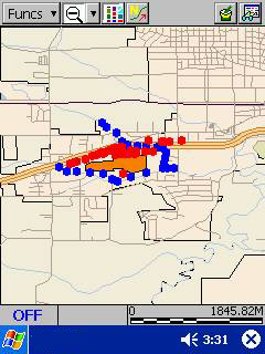
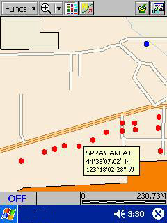
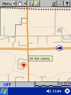
BaseMap
View
·
With
the ability to load BaseMaps, CMT’s Field CE GIS provides a beautiful and
useful background for your lines, points, and areas. ·
BaseMaps
can easily be toggled on or off depending on your preference. ·
BaseMaps
assist in both navigation and data collection. |
||
|
|
|
||
|
|
Map
Functions
·
Similar
to PC-GPS, Field CE GIS provides easy to use Zoom and Pan functions. ·
Feature
and Coordinate Information are conveniently provided when a feature is
selected. |
||
|
|
|
||
|
|
Navigation
·
Field
CE GIS provides real-time navigation on a BaseMap. ·
Navigation
functions include: § Auto Scroll - Automatically scrolls the display when the
navigation marker reaches the edge of the display. § Auto Zoom - Automatically zooms to center the
navigation marker. § Target Beep - Audible alarm that
will notify the user when they have arrived within the specified distance
from the target. § Tolerance - Creates a circle with
radius at the specified distance around the navigation target. |
||
|
|
|
||
|
|
HUD
Features
·
Field
CE GIS provides (in the field) HUD (heads up digitizing) capabilities. ·
Digitizing
a point, line, or area feature is easier than ever with Field CE GIS’s add
feature function. |
||
|
|
|
||
|
|
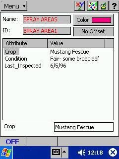
Attribute/Value
Information
·
With
the click of a button, Field CE GIS provides attribute and value information
recorded for the selected feature. |
||
|
|
|
||
|
|
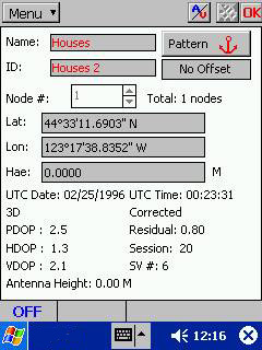
Coordinate
Information
·
With
the click of a button, Field CE GIS provides coordinate information for the
selected feature. ·
Toggle
between Attributes/Values and Coordinate Information for the selected
feature. |
||
|
|
|
||
|
|
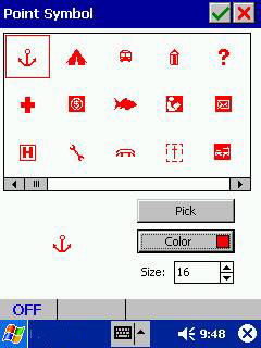
Point
Symbol Pick List
·
Field
CE GIS allows you to change your point symbols on-the-fly. ·
Change
size and color of the symbol to fit the needs of your application. |
||
|
|
|
||
|
|
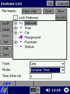
Feature
List
§
Field
CE GIS provides on-the-fly creation or editing of Feature Lists for efficient
data collection. |
||
|
|
|
||
|
|
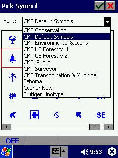
Symbol
Libraries
·
Field
CE GIS also provides multiple point symbol libraries to choose from. ·
Libraries
included are: Conservation, Forestry 1, Forestry 2, Public, Transportation
& Municipal, Environmental, and Default Symbols. |
||