3-D shaded relief
| Rated #1 in the June 2005 issue of the Journal of Forestry! In the article titled: "Digital Mapping Alternatives: GIS for the Busy Forester", PC-GIS is compared side-by-side with several GIS programs. PC-GIS is rated #1 for the level of functionality at an affordable price. | ||
|
PC-GIS PRO is economical and easy to learn.
PC-GIS PRO includes the Forester’s Toolkit. Foresters, farmers, wildlife specialists and other land managers can customize the Toolkit for their specific applications. |
| PC-GIS has a complete GIS interface: |
| Topic View is used to control layer order, legends, classification schemes and automatic labeling. | Map View displays your map with different symbols, background maps, aerial photos and linked media. | Sheet View is a spreadsheet containing a database of attributes/values used for queries, sorting & reports. |
| Use PC-GIS Pro to georeference images. Then auto-align aerial photo with DRG Map as well as CMT BaseMap. | ||
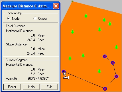
| Heads-up digitize street, stream, parking lot, etc. and measure length and area easily. Create riparian zones using the buffer or offset function. |
|
PC-GIS Pro is popular for Forestry applications. |
||
|
It is great for City, Utility , Farm, and Natural Resources GIS. |
| HIGHLIGHTS | ||||
|
·
BaseMaps with contour lines and 3-D shaded relief |
|
|||
| · GIS functions: Split, Join & more | ||||
| · Buffering for points, lines & areas | ||||
| · Image support for: | ||||
| · MRSID® format | ||||
| · GeoJPEG, JPEG2000 | ||||
| · ECW | ||||
| · Geotiff | ||||
| Heads-up digitizing | ||||
| · Forester's Toolkit included | ||||
| · Huge symbol/pattern library | ||||
| · GPS Navigation | ||||
| · Interactive spreadsheet | ||||
| · Easy to Learn & Friendly to Use |
| Forester’s Toolkit Built-in! | |||
|
Heads-Up Digitize
tracts and stands from georeferenced aerial photo. Share borders to eliminate gaps and overlaps. |
|||
| Split Tract/Stands into smaller areas along borders or other boundaries | |||
Combine Tracts/Stands and join along common boundaries to form larger areas. |
|||
| Create "Islands" within a tract or stand. The "island" area is subtracted from the tract or stand to show net acreage. | |||
| Register Photos using GPS points or topo maps. View your photo and topo map side-by-side for georeferencing. | |||
| Add Roads, Streams, and other Point, Line and Area Features. Digitize the feature and assign a symbol with a click of the mouse. |
| PC-GIS PRO 09 Software Highlights: |
| · Import/Export data: | · Create: | · Save Plot Preview to JPG or PDF file. | |||||
| ASCII, MS®Excel & Access | Grids (Sampling Plots) | · Link media to features. | |||||
| Shapefiles, DXF files, | Buffers | · Join/Disconnect features. | |||||
| FTR files, PMP files | · Topic: | · Sort features in table. | |||||
| · GPS: | Classification | · Geo-reference and Load photo/images. | |||||
| Navigation | Supplemental Data Mgmt. | · Adjust image transparency. | |||||
| Routing | Automatic Labeling | · Feature List builder for Field CE GIS | |||||
| · Heads-up digitizing | · Contours | · CE BaseMap & Image conversion | |||||
| · Forester's Toolkit | · 3-D shaded relief map | · Google Earth® Interface |
| CMTINC.COM | All Rights Reserved All trademarks are the property of their respective owners. |
||
| email: support@cmtinc.com |