PC-GIS 3.2
|
|||
|
|
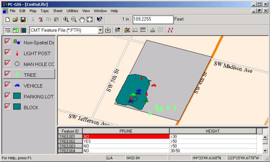
CMT PC-GIS 3.2 is a lightweight GIS software solution for MS
Windows. PC-GIS
3.2 is perfect for educational use in High Schools and Colleges. It is an
easy-to-learn and friendly-to-use introduction to GIS. Applications that
require a more powerful GIS should consider the PC-GIS 3.8 PRO version. |
|
|
|
|
Features include: 4
Basemaps: Displays digitally enhanced maps for background data. 4
Feature
Data Import: ASCII, Shapefile, DXF files. 4
Coordinate
System Conversion: LLA, UTM and State Plane. 4
Automatic
Labeling: Label based
on attributes or predefined values. 4
Heads-Up Digitizing 4 Spreadsheet/Database: Sheet view table displayed below map. 4 Zoom Tools:
Zoom
In/Out, Pan and Zoom Fit icons available. 4
GIS
Layering: Move layers up or down
and turn them on and off. |
|
|
|
|
|
||

|
|
|
|
|