Advanced GPS/GIS Data Collection Software
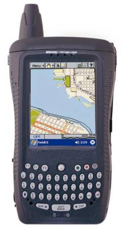
To work on Windows CE PDA device (such as Compaq Ipaq 38xx, Panasonic CF-01, Dell Axim, etc.)

Functions
-Collects raw GPS data for differential correction
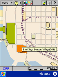
-Detailed, colorful BaseMap background data
-Store GIS Feature, Attribute, and Value
-Works with a GPS Plug-In module (CF Port),
all CMT GPS units and most other GPS receivers
-Point/Line/Area symbols and patterns
-Coordinate system conversion
-Interface with other GIS systems through PC-GPS
and PC-Mapper
-RS232 input from Laser Gun & Bar Code
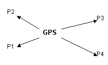
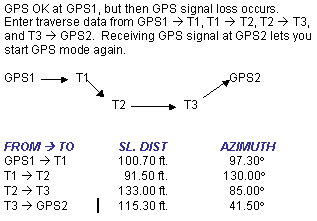
-Store Offset points when GPS signal is weak
-Traverse a series of points when GPS is not
available

Price
CMT Field CE GIS: $985.00 + S/H
GPS Receiver: Optional


Highlights
     
  -Contains all CE GPS/GIS PAD functions
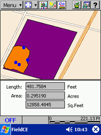
-Distance & Area Measurement tool
-Full GIS Capabilities
-Professional Integrated GPS/GIS
-Real-Time & Post Process Differential
-LLA/UTM/SPC & User Defined Coordinates
-Instant Coordinate update
-NMEA-0183 & GPS raw data
-Local NEZ Plane Support
-Offset & Traverse functions
-Nested Point utility
-Collection modes: Static/Dynamic time and dynamic distance


Nested Points - A must-have powerful feature
Store Points along a Line or Area without "ending" the Line or Area Feature.
For Example, map a road as a dynamic line, also record traffic signs along the road.
   
  Offset - multiple 'shots' can be made from one GPS location

FROM----TO SL. DIST AZIMUTH
GPS ------P1 120.00 ft. 241.30°
GPS ------P2 126.50 ft. 288.80°
GPS ------P3 87.00 ft. 72.00°
GPS ------P4 112.20 ft. 107.50°

   
  Traversing - Available only from CMT    


  Length and Area Tool

Click a button to show length and area for the selected feature

  GIS Information

Field CE provides a complex GIS database on-board

 
NEZ Plane - A necessity in professional packages

Merge traditional Northings and Eastings on a local plane, with GPS data (latitude/longitude)

  Pick any point on the survey and assign 1000N, 1000E as its coordinates. Go to that point and record a GPS position (shown at A). To produce the correct orientation and scale, pick one other point and record a GPS position (shown at B).

wwGPS Control: 44° 33' 30.168457" N
B) 123° 18' 31.679077" W
wwNEZ Control: 1543.417N, 1024.9288E


wwGPS Reference: 44° 33' 24.79889" N
A) 123° 18' 31.761475" W
wwNEZ Reference: 1000.000N, 1000.000E


    View more screen samples here